Quality at
your service
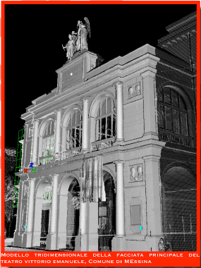
To obtain high-definition relief, laser technology is an ideal solution considering the high detailed three-dimensional digital acquisition and the reduction of time and operators on the field.
Architectural Buildings cultural heritage |
Creation of textured 3D models provides to create detailed and precise maps of degradation
Detection of railways and roads, tunnels, towns, bridges, trees and forests; long-term monitoring of buildings and soil
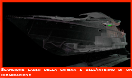
The relief in the yard of boats CONSTRUCTION allows real verify that the project was being respected during the construction
Creation of digital models of systems and database, 3D coordinate for the construction and integration of new structures
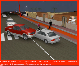
return of accurate data relevant to the scene.crime and accidents in internal or external enviroment